Key Information
| Title | EW4Fthiotida: smart technology for the monitoring and timely response to critical phenomena |
| Hazard | Multi-risk: wildfire, flooding and heavy snowfall |
| Region and Country | Central Greece, Greece |
| Action Type | Early warning solution |
| Further Categorisation | Civil protection; emergency management; cross-agency collaboration |
| Key links | Region of Central Greece — EW4Fthiotida presentation FUTURAL — EW4Fthiotida sub-project |
Context
Fthiotida is one of the five regional units of Central Greece. It includes seven municipalities and approximately 200 villages and small communities. Its geography combines mountains, rivers, fertile plains, forests and coastal areas. Its rural economy depends substantially on agriculture and livestock farming. This varied landscape creates exposure to several climate-related hazards.
The Spercheios River and its tributaries can flood during heavy rainfall and snowmelt, affecting roads, agricultural land and nearby communities. Mountainous areas around Mount Oeta and Mount Kallidromo experience heavy snowfall. Snowfall can block roads, isolate villages, interrupt services and create difficulties for livestock farmers. Forest fires threaten rural communities, ecosystems and high-value agricultural areas, including olive- and pistachio-producing zones.
The Regional Authority is responsible for coordinating civil-protection resources across a large territory, but staff, vehicles and specialist equipment are limited. Before EW4Fthiotida, operational decisions often depended on forecasts, telephone reports and incomplete information, with no single real-time operational picture. The action was therefore designed to improve situational awareness, early warning and the allocation of scarce emergency resources.
Action Description
This action is a multi-risk early warning system. The action brings together technology enabled monitoring with reporting and operational information for the agencies which respond to incidents.
EW4Fthiotida is an integrated digital early-warning and incident-management pilot under implementation for forest fires, floods and heavy snowfall in rural Fthiotida. The software platform has been developed. The Region has completed field inspections and selected strategic locations for the future deployment of cameras, sensors and supporting network equipment. Procurement of the technical equipment is currently in progress. Once the equipment is delivered, it will be installed and connected to the platform for operational testing and validation.
The early warning system is made up of five main components.
AI enabled wildfire detection
Following procurement and installation, fire-detection units (the Meleagros system) will use surveillance cameras and artificial intelligence (AI) algorithms to identify smoke or flames and transmit alerts for assessment and response.
River-level monitoring
Following procurement and installation, river-level monitoring will use Internet of Things (IoT) sensors and algorithms to track water levels and their rate of increase, supporting earlier warning of potential flooding.
Snow and road-condition monitoring
Following procurement and installation, cameras and LoRaWAN (Long Range Wide Area Network) snow-depth sensors will provide evidence on road and weather conditions in mountainous areas, helping the Region prioritise snow-clearing resources.
Mobile crowdsourcing application
A mobile crowdsourcing application enables authorised village representatives and collaborating bodies to report incidents, infrastructure conditions and road-access problems, including photographs and location information. Users also receive official notifications, risk information and protection instructions from the responsible authority through the same application.
CivilOps web platform
The CivilOps web platform has been developed to bring alerts, reports, critical infrastructure and available resources into a common operational picture. The platform operates in the Regional Unit’s coordination centre in Lamia, in place since 2025. It gives Civil Protection and Technical Services staff real-time access to a common operational picture for the first time. Full integration with live field data will take place after the cameras, sensors and supporting equipment have been procured and installed.
Once fully installed and tested, the solution is expected to strengthen resilience through earlier detection, faster information flows and better-informed operational decisions. It is also designed to create a structured communication channel between rural communities and the Regional Unit’s coordination centre.
Timeline & Evolution
FUTURAL is a Horizon Europe Innovation Action coordinated by the Agricultural University of Athens. It runs from 1 June 2023 to 31 May 2027. FUTURAL pilots community-led innovations in six rural areas of the European Union. Its Open Call funds projects that develop their own Smart Solutions under five domains. These solutions are then made available on the FUTURAL Metasearch Platform, a single online access point for Smart Solutions.
EW4Fthiotida is a 12-month sub-project funded through the FUTURAL Open Call, under Grant Agreement No. 101083958. The FUTURAL Sub-grant Agreement for the EW4Fthiotida consortium was signed in March 2025. The sub-project formally started on 1 June 2025.
From June 2025, the design and site-assessment phase covered:
- requirements gathering
- extensive field inspections across the Region
- selection of strategic deployment locations
- equipment specification and procurement preparation
- definition of key performance indicators (KPIs)
- engagement of relevant services and local partners
The software-development phase covered development and configuration of the CivilOps information-collection and incident-management platform, and preparation for integration with the field equipment.
In the current implementation phase, the Region is carrying out the procurement of cameras, detectors, sensors and supporting technical equipment. After delivery, the equipment will be installed at the selected strategic locations and connected to the software platform.
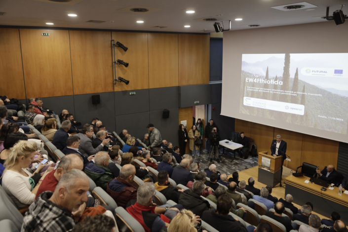
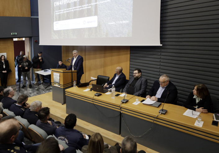
On 12 March 2026, the Region of Central Greece publicly presented the EW4Fthiotida solution, its software environment and its planned operational components in Lamia.
The regional deployment has not yet been completed. Installation, system integration, operational testing and validation will follow the completion of the equipment procurement process. Final operational results will not be available until these steps are completed.
The Open Call solutions are planned to be presented in February 2027 at the final EU-wide Rural Innovation Forum under the wider FUTURAL project.
Actors & Governance
EW4Fthiotida forms part of the Regional Unit of Fthiotida’s wider strategy to modernise its Civil Protection resources using new technology.
FUTURAL project coordination: The Agricultural University of Athens coordinates the wider FUTURAL project. REFRAME.FOOD manages the Open Call and funding administration.
MOBICS S.A.: MOBICS S.A. is the lead partner of the EW4Fthiotida consortium. MOBICS is responsible for overall sub-project coordination, sensing technologies, the AI-based fire-detection system, river-level monitoring, snow sensors and the related IoT network.
Region of Central Greece: The Region is the rural-community and public-authority partner and host of the pilot. The Region has identified operational requirements, completed field inspections over a wide geographic area and selected strategic deployment locations. It is currently procuring the cameras, detectors, sensors and supporting equipment. Following delivery, the Region will coordinate installation at the selected locations and support integration and testing. It will also engage relevant services and community representatives, and assess the potential for wider regional use.
OPSISNET S.A.: OPSISNET S.A. is the technology partner responsible for the CivilOps incident-management platform and the crowdsourcing mobile application, including configuration, integration, training and operational support.
Regional coordination team: Thomas Kapsalis is Scientific Lead for the Region’s participation. Roula Kechri, Advisor to the Regional Governor for European Programmes and International Relations, supports European-programme and institutional coordination. Konstantinos Meletis, Director of the Directorate of Environment and Spatial Planning, supports technical, administrative and procurement coordination.
Local organisations and services: Several local bodies and groups contribute operational knowledge, reports, testing and feedback:
- the Regional Unit of Fthiotida’s civil-protection and technical services
- municipalities, community presidents and village representatives
- emergency services, including the Fire Brigade
- volunteer organisations
- infrastructure operators
- farmers and other rural businesses
Accountability: Accountability is governed by the Sub-grant Agreement and the consortium’s implementation plan, which is structured around defined outputs. The consortium submits an Activity Plan, a Digital Smart Solution Demonstration and a final report on market or community-associated activities. Each is reviewed by the FUTURAL Open Call Advisory Board.
Implementation Considerations
Several factors made delivery possible.
The partnership is complementary. It combines the Region’s civil-protection responsibilities and local knowledge with the sensing and AI expertise of MOBICS and the incident-management software of OPSISNET.
A structured design phase included internal meetings, field visits and site assessments. This work identified hazards, vulnerable areas, power and connectivity constraints, equipment-protection needs and suitable monitoring locations.
The action uses technologies already tested in laboratory or relevant environments. Integration and validation in a real rural operational setting are planned after the field equipment has been procured and installed.
A modular architecture using standard interfaces enables individual components to be adapted, replaced or connected to other platforms.
The Region’s ongoing procurement and administrative work covers the acquisition of cameras, snow sensors, river-level monitoring equipment, LoRa gateways, a server and supporting network equipment. Installation will follow at the locations identified through the field inspections.
Municipalities and trained community representatives participate in the action. Their reports complement automated sensor data and extend coverage into locations where permanent monitoring infrastructure is not available.
The action includes data-protection, access-control and ethical safeguards. These cover compliance with the General Data Protection Regulation (GDPR), data minimisation, secure storage and informed participation.
Important implementation challenges include:
- connectivity and power supply in remote areas
- protection and maintenance of outdoor equipment
- the risk of false AI alerts
- the need to validate citizen-generated reports
- interoperability between different technologies
- the limited staffing and resources of rural authorities
Cost & Resourcing
The total EW4Fthiotida sub-project budget is €120,000. The allocation is €50,000 for MOBICS S.A., €40,000 for the Region of Central Greece and €30,000 for OPSISNET S.A.
The Region’s €40,000 allocation comprises approximately:
- €11,250 for personnel
- €18,000 for equipment
- €1,500 for travel
- €3,500 for specialised installation and subcontracting
- €2,200 for dissemination and other goods and services
- €3,550 in indirect costs
Planned equipment includes six outdoor internet protocol (IP) cameras, one server computer, three LoRa gateways, two snow-depth sensors, one water-level meter and supporting network equipment.
The Region budgeted 4.5 person-months. Required expertise includes:
- civil protection and crisis management
- environmental and spatial planning
- procurement and field installation
- information and communications technology (ICT) networking
- sensor operation
- AI and machine vision
- incident-management software
- engagement with local partners, training and project reporting
At least 7% of the overall funding was reserved for dissemination and community-engagement activities.
Co-Benefits & Trade-Offs
Co-benefits
A common operational picture for multiple hazards: The system brings fire, floods and snowfall into one common operational picture. Separate systems for each hazard are not needed.
Communication and trust: The action improves communication and trust between the Regional Authority, municipalities, community representatives and field actors.
Protection of rural production and services: The action protects agricultural production, livestock, forests, infrastructure, business continuity and access to essential services.
Efficient use of limited resources: The action allows more efficient use of limited vehicles, staff and equipment. It has the potential to reduce unnecessary deployments, fuel consumption and response costs.
Digital skills and operational capacity: The action develops digital skills and operational capacity for regional staff and participating rural communities.
Reusable digital infrastructure: The digital infrastructure can support additional hazards, services and geographic areas.
Trade-offs and limitations
Initial and continuing costs: The system carries initial and continuing costs for equipment, connectivity, licences, maintenance, calibration and technical support.
Detection errors: Automated detection can generate false positives or miss events, so human verification and clear operational procedures remain necessary.
Privacy and security: Camera and crowdsourcing functions require careful privacy, cybersecurity and access-control arrangements.
Coverage limits: Coverage depends on the number and location of sensors and cameras. Remote areas without connectivity or power may remain less visible.
Reliance on community reporting: Community reporting improves local intelligence but requires training, sustained participation and validation to avoid incomplete or competing reports.
Equity Considerations
EW4Fthiotida was not designed as an explicitly equity-centred intervention. Nevertheless, it can provide important distributional benefits by improving early warning and emergency coordination for remote mountain villages, agricultural communities and locations with limited access to services or monitoring infrastructure. These communities can be disproportionately affected by blocked roads, delayed emergency response, wildfire and flood damage.
The crowdsourcing application gives trained local representatives a direct route to the Regional coordination centre, while notifications can improve access to timely information. There is an opportunity to strengthen equity in future deployment through monitoring:
- geographic coverage
- accessibility for people with limited digital skills or connectivity
- representation of smaller communities
- whether warnings and response resources reach high-risk groups consistently
Impact & Evidence
The Region of Central Greece has completed extensive field inspections and identified strategic locations for cameras, detectors and sensors across a wide area. The software that will collect, display and manage the information has been developed. The Region has not yet completed the physical deployment. Procurement of the technical equipment is in progress, and installation, integration and operational testing will follow after delivery. The action is therefore under implementation and is not yet a completed or fully validated pilot.
The project proposal established measurable targets:
- at least 95% incident-detection accuracy
- 99% system availability
- a 30% improvement in resource-allocation efficiency
- participation by at least 30 village representatives
- direct or indirect coverage of more than 10 villages and over 4,000 residents through the fire and flood components
The proposal also anticipated involvement of more than 50 key users and benefits for a wider rural population exceeding 10,000 residents. These figures are targets from the proposal. They are not achieved results and require validation data.
Evidence to be collected includes:
- the actual number and locations of installed devices
- participating villages and users
- system uptime and detection accuracy
- response-time improvements and incidents detected
- training delivered
- feedback from regional or community users
Best Practice Principles
EW4Fthiotida has strong transfer potential because many rural Mediterranean regions face the same combination of large territories, limited civil-protection resources, dispersed settlements and exposure to wildfire, flooding and extreme winter weather. Its principal transferable lessons are set out below.
Start with operational needs and field conditions
Map hazards, vulnerable locations, existing workflows, available resources, connectivity and maintenance capacity before selecting equipment.
Combine automated monitoring with trusted local reporting
Sensors and AI provide continuous evidence, while trained community representatives extend coverage and add contextual knowledge.
Integrate multiple hazards and resources in a common operational picture
Shared platforms can reduce fragmentation and improve prioritisation during complex events.
Use modular, interoperable components
Standard interfaces and configurable tools make it easier to adapt the solution to different hazards, budgets and existing systems.
Complete the pilot under real operating conditions and measure performance after the equipment has been installed
Detection accuracy, false alarms, system availability, response time, resource use and user acceptance should be assessed before scaling.
Plan for sustainability from the start
Authorities should account for licences, connectivity, equipment maintenance, calibration, technical support, training and long-term ownership of data and infrastructure.
Build institutional and community ownership
Municipalities, civil-protection services, community representatives and local organisations should participate in site selection, testing, protocols and evaluation.
Next Steps
The next step is to complete the procurement of cameras, detectors, sensors and supporting technical equipment. The equipment will then be installed at the strategic locations selected through the Region’s field inspections and integrated with the developed software platform. Operational testing and validation of the integrated system will follow, with verified results documented against the agreed KPIs.
Authorised regional staff and collaborating users will be trained. Procedures for alerts, verification, escalation, resource dispatch and coordination with local and emergency services will be formalised.
After validation, additional sensor and camera coverage will be assessed in Fthiotida and, where evidence supports it, in other regional units of Central Greece. Sustainable financing for licences, connectivity, maintenance and expansion will be explored, including regional budgets, European programmes and appropriate public-private cooperation. The solution and its lessons will be connected with the FUTURAL Metasearch Platform, and the results presented through the EU-wide Rural Innovation Forum.